General Facts:Total Area: 342,000 sq km
Land Area: 341,500 sq km Water Area: 500 sq km Size (comparative to the U.S.): Slightly smaller than Montana Bordering Countries: Angolia, Cameroon, Central African Republic, Democratic Republic of Congo, Gabon. Total distance of Land Boundaries: 5,504 km Total distance of Coastline: 169 km Climate: Tropical; rainy season (March to June); dry season (June to October); persistent high temperatures and humidity; particularly enervating climate astride the Equator. Terrain: Coastal plain, southern basin, central plateau, northern basin. Point of Lowest Elevation: Atlantic Ocean 0 m Point of Highest Elevation: Mount Berongou 903 m ALL Facts and statistics listed above are From: https://www.cia.gov/library/publications/the-world-factbook/geos/cf.html 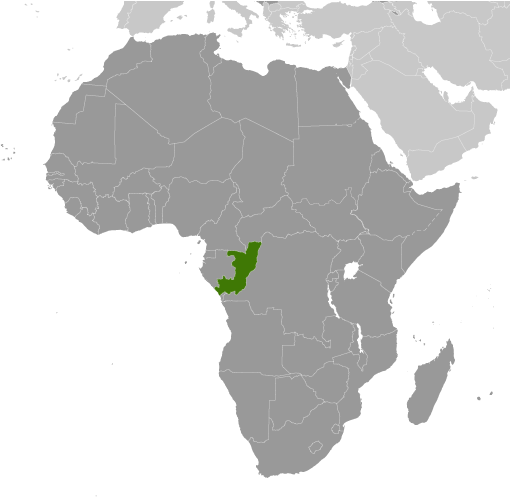
Photo Source: https://www.cia.gov/library/publications/the-world-factbook/maps/cf_largelocator_template.html
|
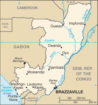
Photo Source: https://www.cia.gov/library/publications/the-world-factbook/maps/maptemplate_cf.html
|
